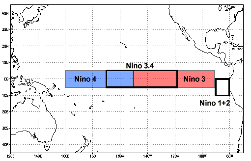
Here's an unusual change -- a sharp increase in the sea surface temperature anomaly of the
Nino34 region in the central Pacific Ocean -- the region taken to be most indicative of the ENSO state. The anomaly is now in El Niño territory, as it's above 0.5°C. (It takes 5 months being above this value to make an official El Niño, in the eyes of NOAA.)
So no El Niño
yet, but still a impressive spike.

2 comments:
MET says: "Consensus is growing among scientists from a range of climate centres across the world that a weak El Niño is likely to occur during the coming northern hemisphere winter."
- https://blog.metoffice.gov.uk/2018/09/26/a-weak-el-nino-is-likely/
That is in line with the most recent BOM projection.
http://www.bom.gov.au/climate/enso/#tabs=Outlooks
Post a Comment